Dunsmuir & Mt Shasta for four: Sahir, Preksha and Sahir's parents. Every waterfall below has an exact parking pin, a measured distance and grade, a map of the walk, and a straight answer on whether you can get in the water.
Last updated 2026-09-27 12:05 PT · distances and grades measured on OpenStreetMap trail geometry against the USGS 10 m elevation model, not copied from blogs.
☕ Mornings are coffee-only. Cappuccinos made at camp, no sit-down breakfast either day. Saturday that puts you at McCloud Falls by 9 with the lots still empty; Sunday it gets you on the road before the I-5 heat.
Saturday planHedge Creek first, then the McCloud falls with a picnic and swim at Lower, then Lake Siskiyou for a warm swim and sunset. It ends with the BBQ and fire at camp.
🌤️ Tomorrow’s weather. Dry all day (0–1% rain). Overcast morning, clearing by mid-afternoon. 11–12°C at 8 am, 23–24°C at 4 pm, light wind (gusts ~20–25 km/h after lunch). Bunny Flat is 12–13°C and feels like 9°C. Sunset 6:59. The BBQ at 7:30 will be about 20°C falling to 17°C by 9 pm.
✓
Headwaters → McCloud falls → Lake Siskiyou
The plan, updated 11:50 am
🚗 About 1 h 45 more driving; Bunny Flat is dropped for time🚶 All the walks left today are flat🏊 Swims: Lower McCloud (cold) and Lake Siskiyou (warm)☀️ Dry; overcast morning, 24°C by 4 pm
✓ 9:00
Hedge Creek Falls. Done.
✓ 11:15
Lunch at Highland House, Mount Shasta Resort. Done.
12:30
Headwaters spring, Mt Shasta City Park (10 min from the resort). Fill every bottle straight from the source of the Sacramento River. About 20 min. Google Maps
1:00
Drive to McCloud (31 min from the park): I-5 south to Hwy 89 east.
1:30
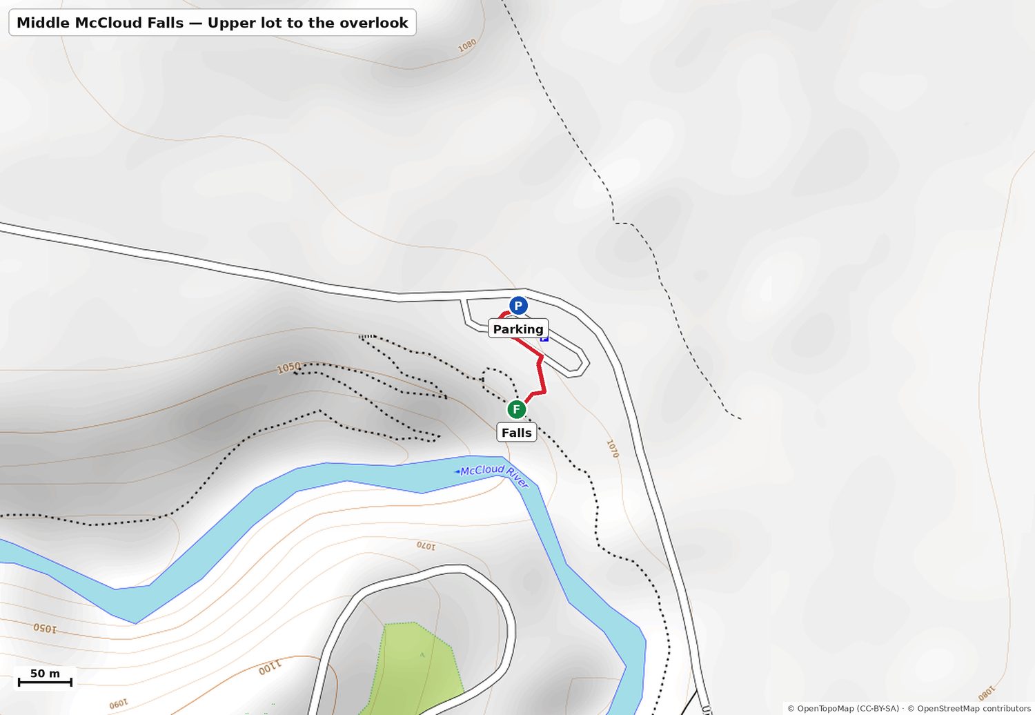
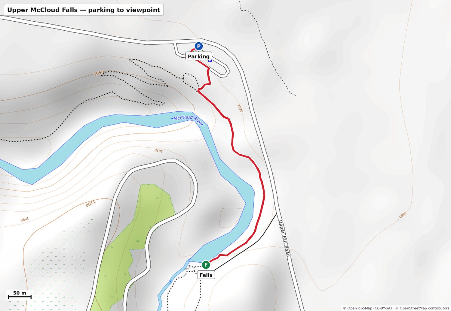
Optional: Upper Falls lot. Flat 0.4 mi to the Upper Falls viewpoint, plus the railed Middle Falls overlook 100 yards from the same lot. About 30 min. Photos & map
2:00
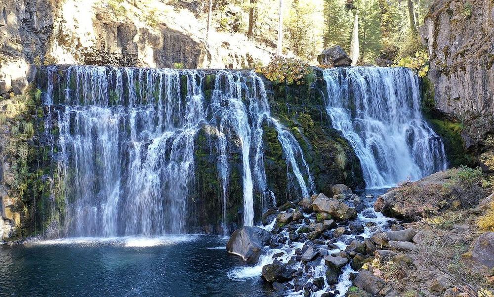
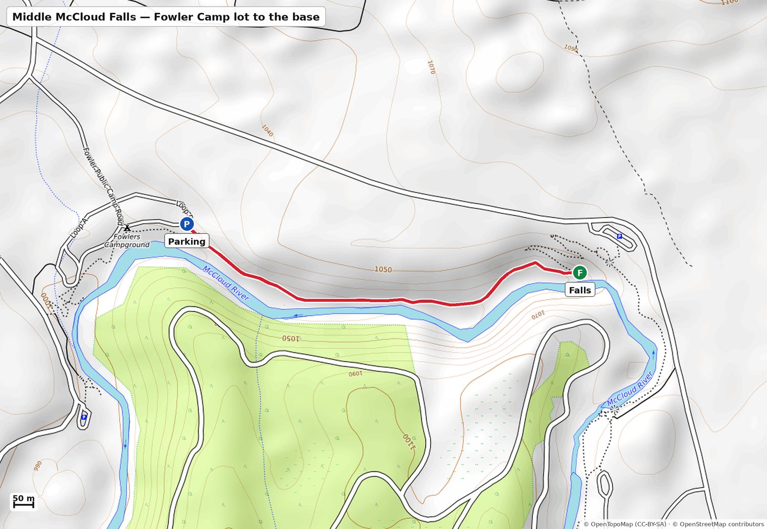
Middle McCloud Falls from the Fowler Camp lot. Flat 0.7 mi each way to the base of the 50 ft curtain. Don't take the steep switchbacks down from the overlook. About 1 h 15. Photos & map
3:15
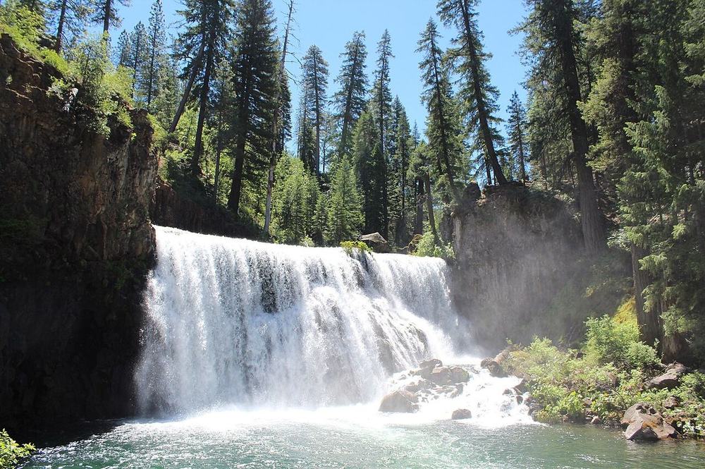
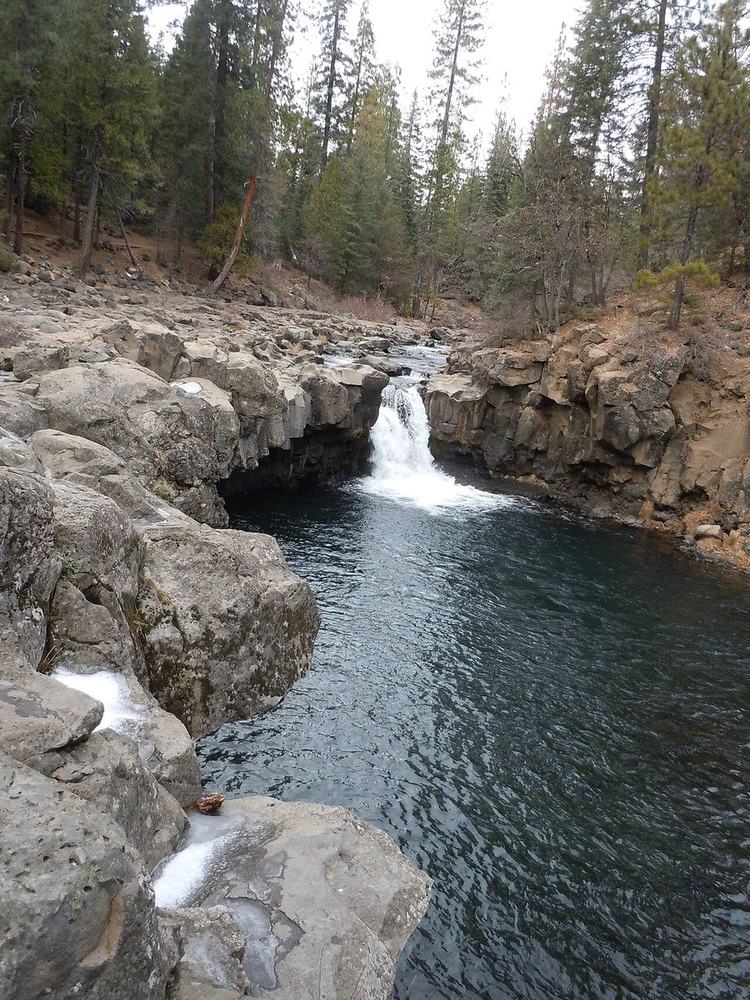
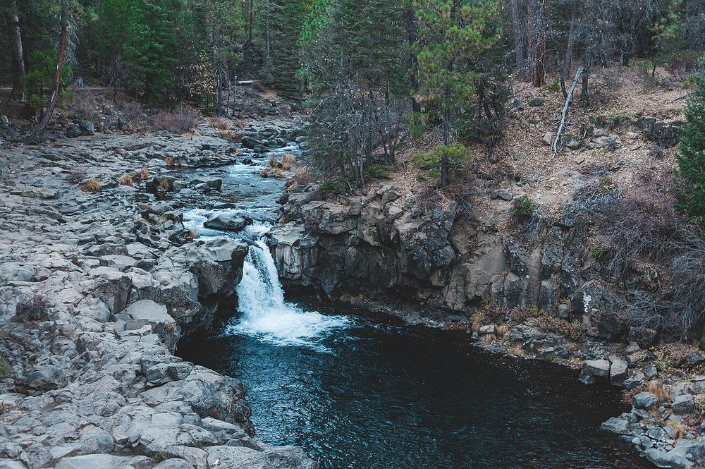
Lower McCloud Falls: swim. Stone steps into the pool. The water is 8–11°C but the air is at its warmest (about 24°C), so it's a quick dip. No jumping. Toilets here. Photos & map
4:00
Drive to Lake Siskiyou (31 min).
4:30
Lake Siskiyou, Wagon Creek Bridge lot. The warm swim (17–19°C), the beach sheet and folding chairs, then sunset at 6:59. Google Maps
7:15
🔥 Back to camp for the BBQ and fire. About 20°C at 7:30, falling to 17°C by 9 pm, so bring layers.
📱 WhatsApp version with Google Maps links
⛰️ Saturday afternoon (updated)
Warm by 2–4pm (~24°C). Swimsuits, towels, a warm layer, water bottles.

✅ Hedge Creek Falls, done
✅ Lunch at Highland House, done

💦 12:30 Headwaters spring, Mt Shasta City Park (10 min): fill the bottles
📍 https://www.google.com/maps/dir/?api=1&destination=41.32776,-122.32579

🚗 1:00 Drive to McCloud (31 min)

👀 1:30 Upper Falls + Middle Falls overlook (optional, flat, ~30 min)
📍 https://www.google.com/maps/dir/?api=1&destination=41.24465,-122.0088

🌊 2:00 Middle McCloud Falls, from the FOWLER CAMP lot
Flat 0.7 mi to the big falls. Don't take the steep switchbacks from the overlook
📍 https://www.google.com/maps/dir/?api=1&destination=41.24465,-122.02181

🏊 3:15 Lower McCloud Falls: swim
Stone steps into the pool. Water 8–11°C, so a quick dip. No jumping
📍 https://www.google.com/maps/dir/?api=1&destination=41.24027,-122.0252

🏖️ 4:30 Lake Siskiyou (31 min): warm swim (17–19°C) + sunset 6:59
📍 https://www.google.com/maps/dir/?api=1&destination=41.2859,-122.32376

🔥 7:15 Back to camp: BBQ + fire

Full page: https://artifact.sahirm.com/a/shasta-weekend-sep-2026/#saturday
The other options we considered (B, C, D)
B
McCloud, the mountain, the lake
My pick: closest to the original plan
🚗 ~2 h 20 driving🚶 All flat or near-flat; nothing over 0.7 mi each way🏊 Lower McCloud (8–11°C, bracing) and Lake Siskiyou (17–19°C, the warm one)
8:15
Coffee at camp, roll out
9:00
McCloud Falls, all three, with the swim at Lower. Empty lots this early
11:45
Mt Shasta City: lunch, and fill every bottle at the headwaters spring in City Park
2:15
Everitt Hwy up to Bunny Flat (2,120 m). 12°C, feels like 9°C, so jackets on. Short Panther Meadows loop if everyone's up for it
4:15
Lake Siskiyou: afternoon swim in the warmest water of the trip, then stay for sunset at 6:59
7:30
BBQ and fire at camp
The original plan minus Burney: every highlight, half the driving, and the lake swim moves from maybe to definitely.
C
Slow day close to camp
Easiest on everyone
🚗 ~1 h 40 driving, in short hops🚶 Paved 0.2 mi overlook; everything else is flat🏊 Cantara Loop (13–16°C) and Lake Siskiyou (17–19°C)
9:00
Slow coffee and chai at camp; no alarm
10:30
Castle Crags Vista Point ($8): paved 0.2 mi to the Crags-and-Shasta view. Optional Root Creek walk for anyone restless
12:30
Cantara Loop: picnic on the little beach, river swim, 14 min from camp
2:30
Back at camp: nap, hammock, whatever
5:30
Lake Siskiyou for sunset at 6:59
7:30
BBQ and fire at camp
Skips the McCloud falls and the mountain. Best if Friday's drive wiped everyone out, or if the parents want a gentle day before the drive home.
D
Waterfalls and swimming holes
Water all day, no mountain
🚗 ~2 h driving🚶 Flat, except Hedge Creek (76 ft back up to the car)🏊 Lower McCloud (8–11°C), Cantara (13–16°C), Lake Siskiyou (17–19°C)
8:15
Coffee at camp, roll out
9:00
McCloud Falls, all three, with the swim at Lower
12:00
Back toward camp: Hedge Creek Falls, 3 min from the door, where you walk behind the curtain
1:00
Cantara Loop: picnic and river swim
4:00
Lake Siskiyou: last swim, then sunset at 6:59
7:30
BBQ and fire at camp
Swaps the mountain for water, and moves Hedge Creek up from Sunday, which frees Sunday morning to leave early.
All the waterfallsBest first. Drive is one way from Cave Springs Resort; walk is one way from the car. Google Maps opens directions to the parking spot.
💧 How much water right now. The USGS gauge on the upper Sacramento at Delta read 215 cfs tonight. The 81-year median for 26 September is 213, so this is a completely normal late September. What that means: spring-fed falls are full (all three McCloud falls, Burney, Mossbrae). Rain- and snowmelt-fed creeks are at their seasonal low (Hedge Creek thin, Faery low, Root Creek and Sweetbriar probably dry). The photos are mostly spring shots, so expect less at those four.
Middle McCloud Falls
⭐ Recommended
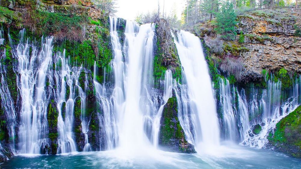
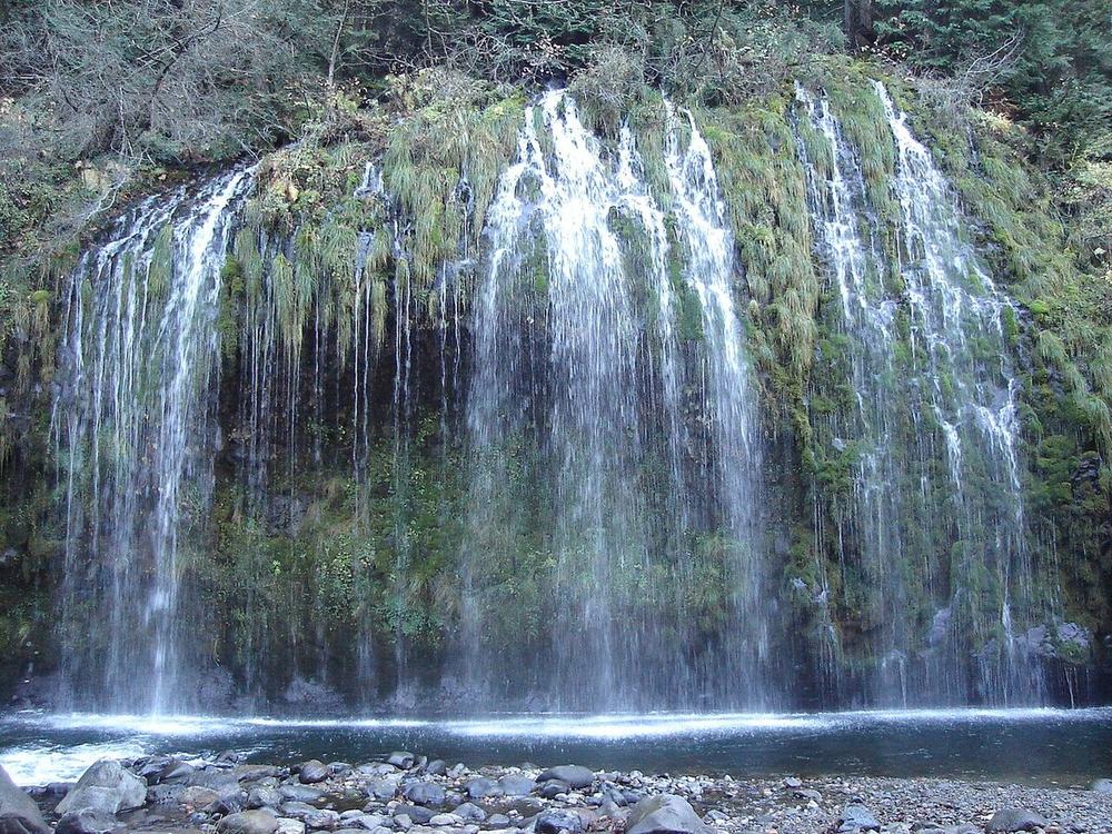
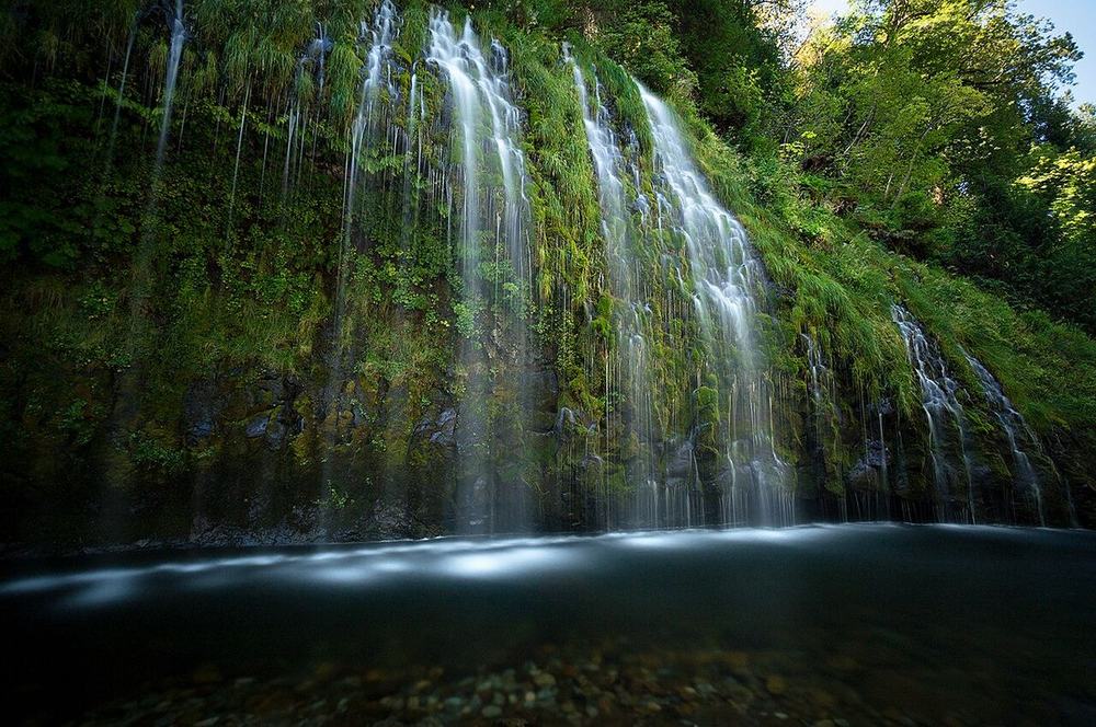
The showpiece: a 50 ft curtain. Walk in flat from the Fowler Camp lot
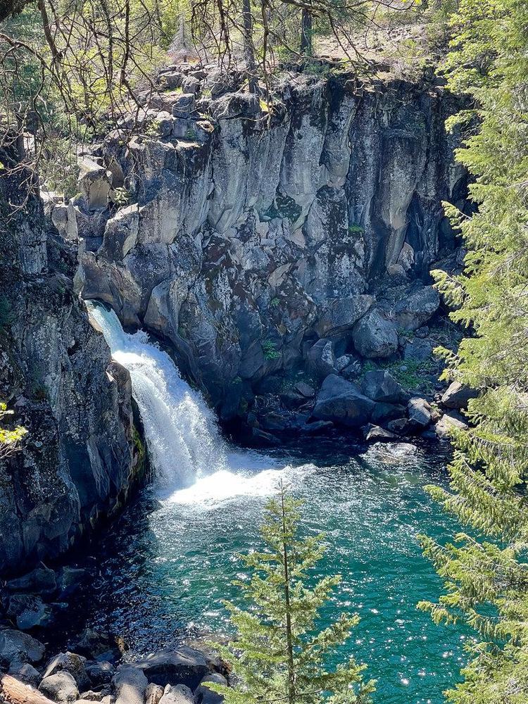
The swimming one: stone steps into a deep pool, 2 minutes from the car
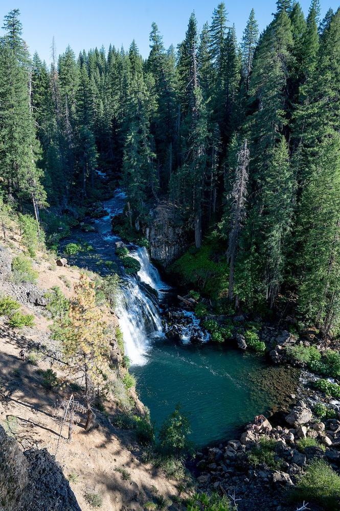
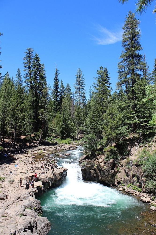
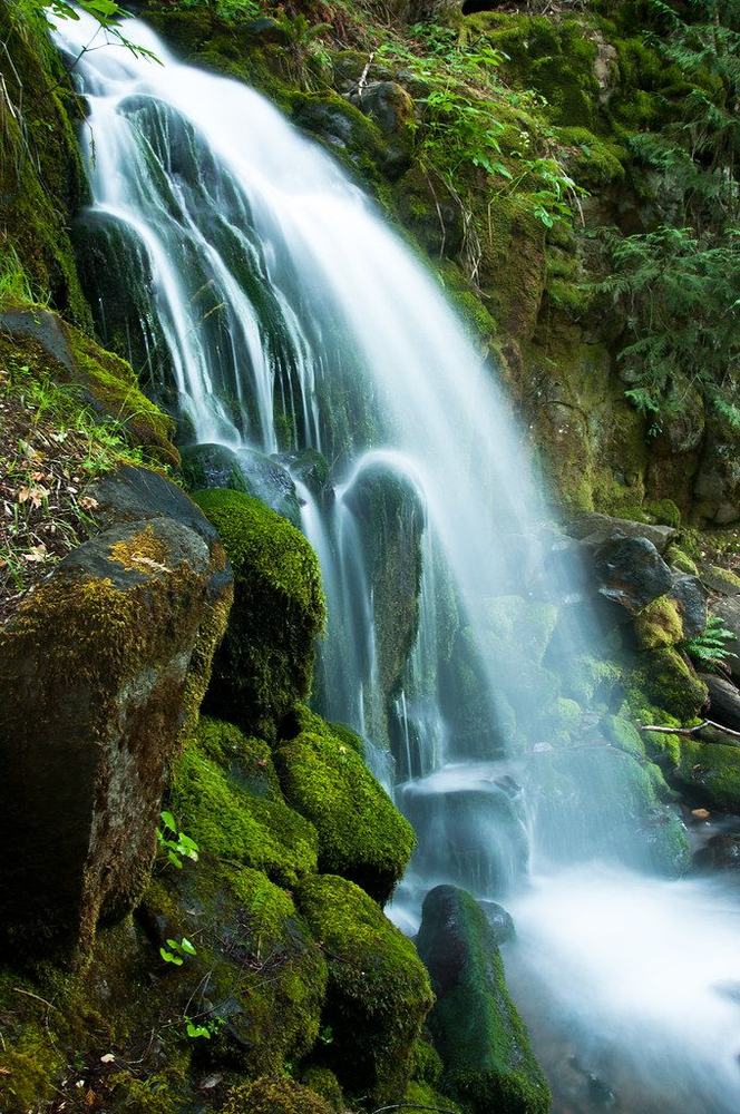
The pool: this is the swimming onePhoto: Pacific Southwest Region 5, Public domainRock shelf and plunge poolPhoto: Pinecar, CC BY-SA 3.0From the rim abovePhoto: Michael Kahn, CC BY-SA 4.0
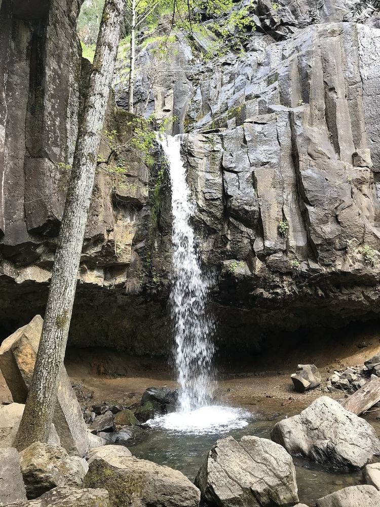
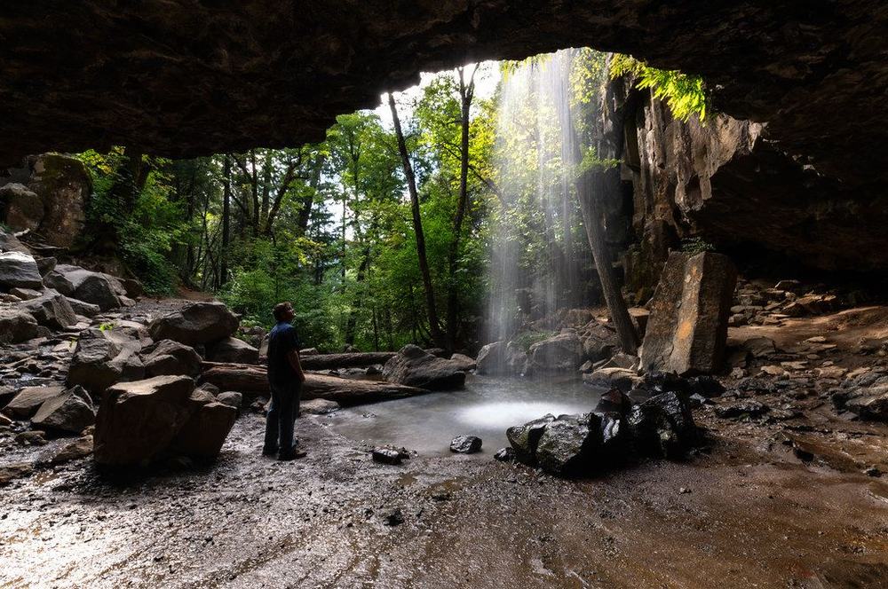
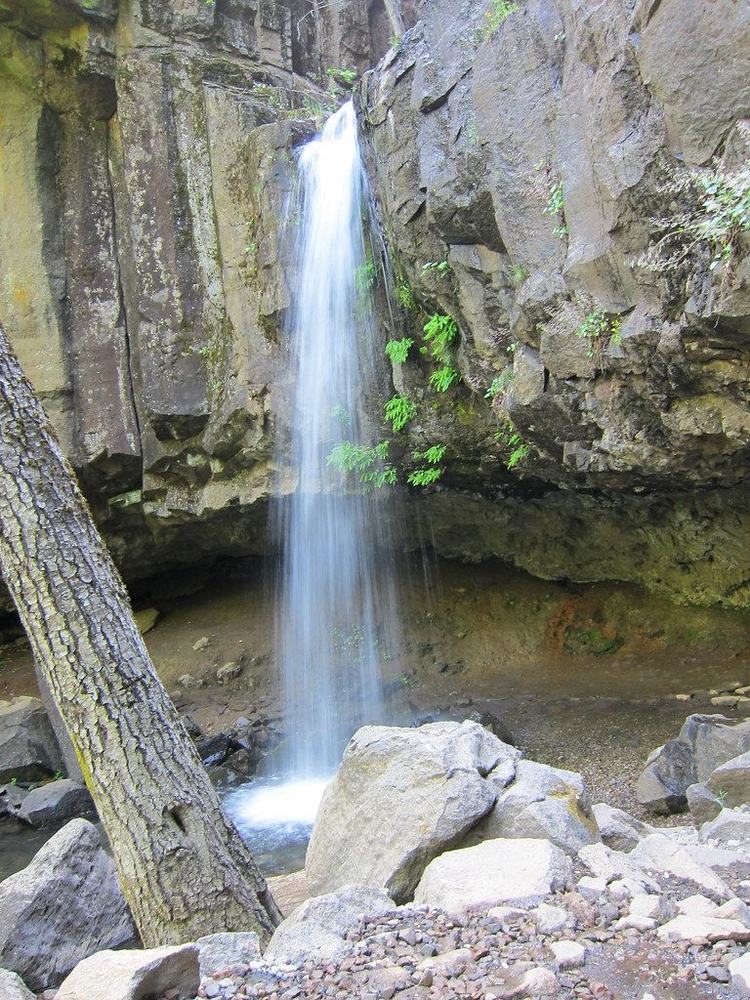
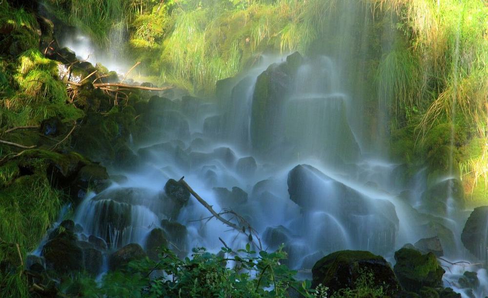
2 minutes from the door, and you walk behind the falls
The falls and its basalt alcovePhoto: Ilya.osipov, CC BY 4.0From inside the alcove, behind the curtainPhoto: Patrick Gillespie, CC BY 2.0The drop, straight onPhoto: amitp, CC BY 2.0
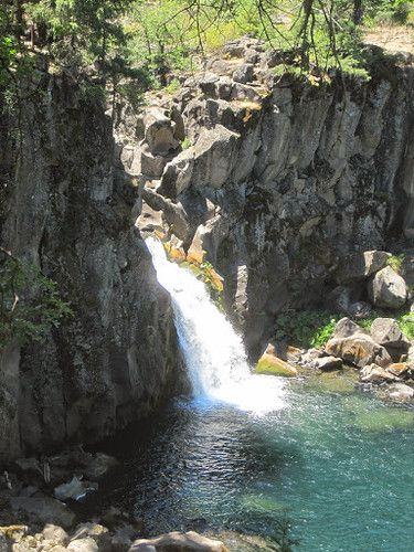
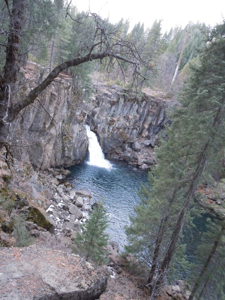
Worth the flat 10-minute add-on while you're at McCloud
Upper Falls from the rim trailPhoto: JingKe888, CC BY 2.0The chute into the gorgePhoto: bubbletea1, CC BY-NC-SA 2.0The basalt gorge belowPhoto: Pinecar, CC BY-SA 3.0
Sunday option A: a 30 min walk up, and the viewpoint is easy. Water is low and the last bit to the pool is a scramble
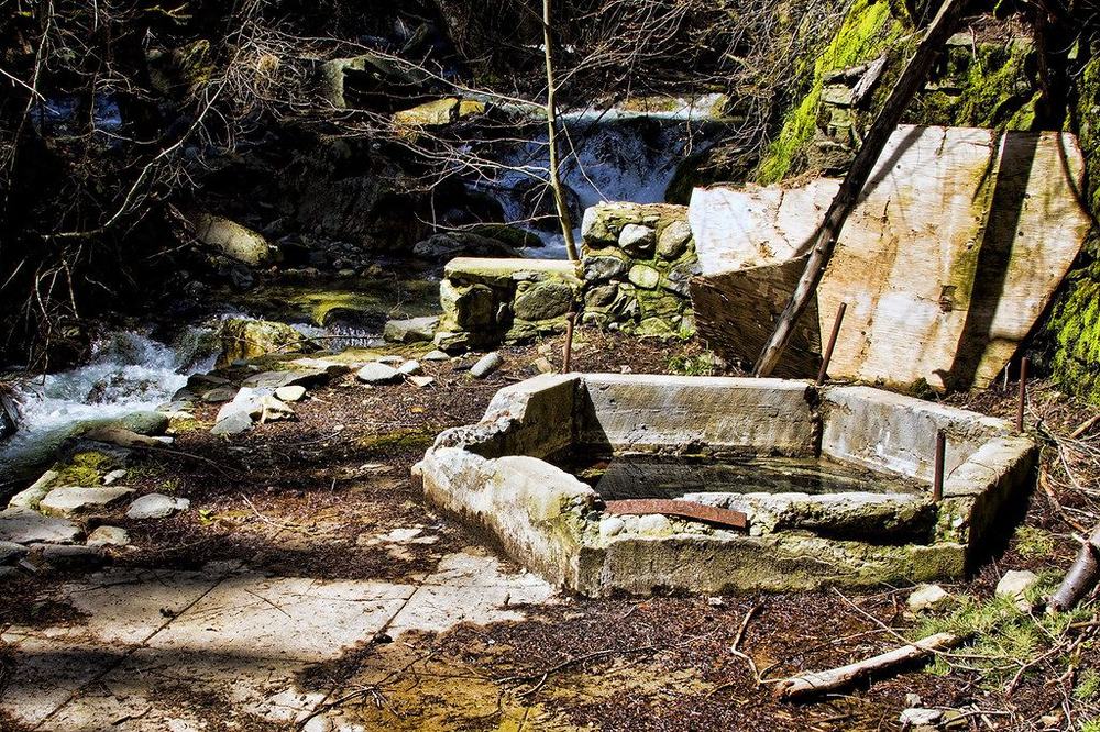
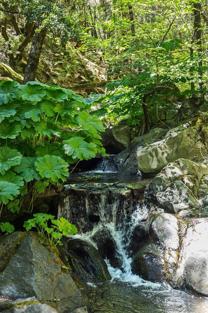
Faery Falls in April flow (expect less in late September)Photo: ronWLS, CC BY-NC 2.0Ney Springs resort ruins, passed on the way inPhoto: ronWLS, CC BY-NC 2.0Ney Springs Creek below the fallsPhoto: Vethod, CC BY-NC-ND 2.0
Nice walk, but the falls usually stops by late summer
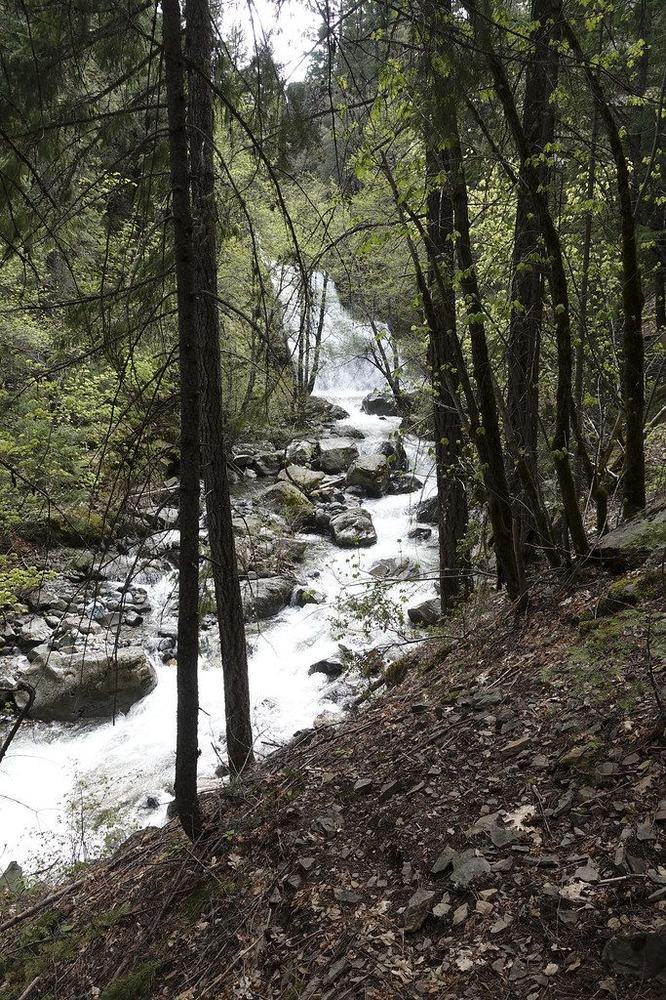
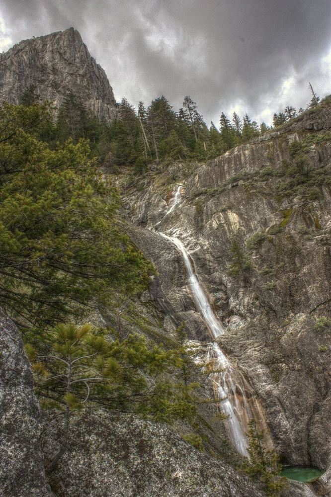
The falls down the granite, in springPhoto: Jillian Kern, CC BY-NC-ND 2.0Root Creek near the end of the trailPhoto: J. Maughn, CC BY-NC 2.0Root Creek in summerPhoto: Jillian Kern, CC BY-NC-ND 2.0
Warmer swims that aren’t waterfalls: Cantara Loop (16 min, 13–16°C) and Lake Siskiyou (15 min, 17–19°C, the warmest).
Packing listWhat to take, cut down from the Notion list for where we’re staying. Tick items off as they go in the car. Ticks sync live, so anyone with this link sees the same list. Anyone can add things too: use the add box at the bottom of the buy list and of the pack list.
0 / 0 packed connecting…
Ticking as
🛒 Buy listonly what’s still unbought, as of right nowWhatsApp →
Preview
🧳 Pack list + linkwhat’s still to pack, and the link to tick it offWhatsApp →
Preview
Buy — Berkeley Bowl
Tick when it’s bought. Everything here goes in the car too. Berkeley Bowl is 9 am–8 pm, so do that run before you leave Friday.
Buy — Jazeera Market, Alameda
Buy — propane refill
Fill it Friday before you leave. It needs to be full for the BBQ and the fire pit on Saturday.
Pagano’s Hardware, 2298 South Shore Center, Alameda · 9 am–6 pm daily · refills and exchanges. The easy one on the way out
Encinal True Value Hardware, 2801 Encinal Ave, Alameda · Fri 8 am–6 pm · lists propane service, so call to confirm it's refills: (510) 523-4821
Alameda Auto Lab, 631 Buena Vista Ave, Alameda · Fri 8:30 am–5:30 pm · refills all tank sizes. (510) 522-0510
U-Haul of Oakland, 5330 International Blvd, Oakland · 7 am–8 pm · latest open. $3.85/gal (about $18 for a 20 lb tank)
Backup up north (Saturday):
AmeriGas Propane Refill, 30877 Crag View Dr, Castella · 8 am–8 pm daily on Google Maps · ~10 min south of camp, and reviewers say fills are quick and cheap. Call first: (530) 227-5415
Skip Blue Star Gas in Mt Shasta: it’s closed Saturdays. On the drive, keep the tank upright and strapped in, not rolling around the trunk.
➕ Add to the buy list
Food from home
Clothes & layers
Swimming
Sun, bugs & safety
Day trips & picnic
Coffee & chai
Drinks & fun
BBQ & evening fire
Paperwork & money
➕ Add to the pack list
Don’t need to pack
From your Notion list. Crossed out because the place already has it, or the trip doesn’t need it. Tick one if you want to pack it anyway. These don’t count toward the progress bar.
The weekendTimes are targets, not a schedule.
Friday 25 Sep — The drive up
4:30 pm
Leave Alameda. 266 mi to Dunsmuir. OSRM says 5h; Google will quote ~4h20 with clear roads. Friday evening you'll lose 30–40 min on I-80/I-505, so a 5 pm departure lands you at 9:30–10 pm.
on the road
Dinner. Everything in Dunsmuir shuts by 9. Black Bear Diner in Mt Shasta runs to 10 pm and is the only realistic late option — otherwise eat in Alameda before you go.
~9:30 pm
Arrive. Heads up: Dunsmuir River Days runs Fri 6 pm – Sat 9 pm downtown. Live music, some street closures, busier town than usual.
Saturday 26 Sep — Hedge Creek, the McCloud falls, Lake Siskiyou
all day
See the Saturday plan at the top: Hedge Creek 9:00 → Upper and Middle McCloud → picnic and swim at Lower McCloud → the headwaters spring → Lake Siskiyou swim and sunset → BBQ and fire at camp at 7:30.
Sunday 27 Sep — Pick one: A, B or C
8:00 am
☕ Coffee and chai, pack up. Check out by 10.
Option A
🌿 Faery Falls (Ney Springs) first thing, then straight home. Leave camp by 7:45: it's 23 min, past Lake Siskiyou, and the last stretch of Ney Springs Rd is unpaved and bumpy (fine for a normal car taken slowly). The walk is 0.7 mi each way, uphill on the way in (259 ft, steady rather than steep), about 30 min up past the old Ney Springs resort ruins. The viewpoint at the top is easy. The last bit down to the pool is a loose scramble, so parents stop at the viewpoint. Water is low this late in the season: a 40 ft cascade, not the spring torrent in the photos. Back at camp by about 9:40, check out, then optional Castle Crags Vista Point on the way south. Home around 3 pm.Google Maps (parking) · Photos
Option B
🦇 Lake Shasta Caverns. Check out, then optional Castle Crags (17 min, $8, paved 0.2 mi), then the caverns (49 min south, exit 695). Arrive 30 min before your boat; call (530) 238-2341 for Sunday times or book at book.singenuity.com/473. $46 adults (16+), which covers the boat, bus, guided cave tour and light show, about 2 h. 600+ stairs: not recommended for bad knees, back or heart conditions.Home around 6 pm.Google Maps
Option C
🌉 Flat and free. Check out, then Castle Crags viewpoint, then Shasta Dam (walk the crest; the free tour goes inside by elevator; tickets first-come an hour before each tour, (530) 247-8500), then lunch and the Sundial Bridge walk in Redding (free, flat, Turtle Bay gardens next door). Home around 5 pm.Shasta Dam · Sundial Bridge
Also doable
A + B together: Faery Falls at 7:45, check out by 10, then the caverns about 11. That's a full day, home around 6 pm.
🌊
Sunday drive home: 4 water stops
Pick one. Detour = extra driving vs going straight home
📱 WhatsApp version
🌊 Drive home: 4 water stops (pick one)
Straight home = ~4.5–5 h. Detour = extra driving on top of that.

🅰️ CRYSTAL CREEK FALLS (Whiskeytown)
💧 A waterfall that runs all year + a swim hole at the base
🌡️ Water ~14–17°C (estimate)
🚶 0.4 mi each way, PAVED and flat. Short steep dirt path down to the pool
🚗 Detour: +75 min
🎟️ $25/car park pass, card only
🛍️ No downtown (lunch in Redding)
🏠 Home ~7:30
📍 https://www.google.com/maps/search/?api=1&query=Crystal+Creek+Falls+Crystal+Creek+Rd+Whiskeytown+CA

🅱️ RIVER SWIM HOLES BY CAMP (Hedge Creek river + Cantara Loop)
💧 Two Sacramento River spots
🌡️ Water 13–16°C (Cantara from real gauge records)
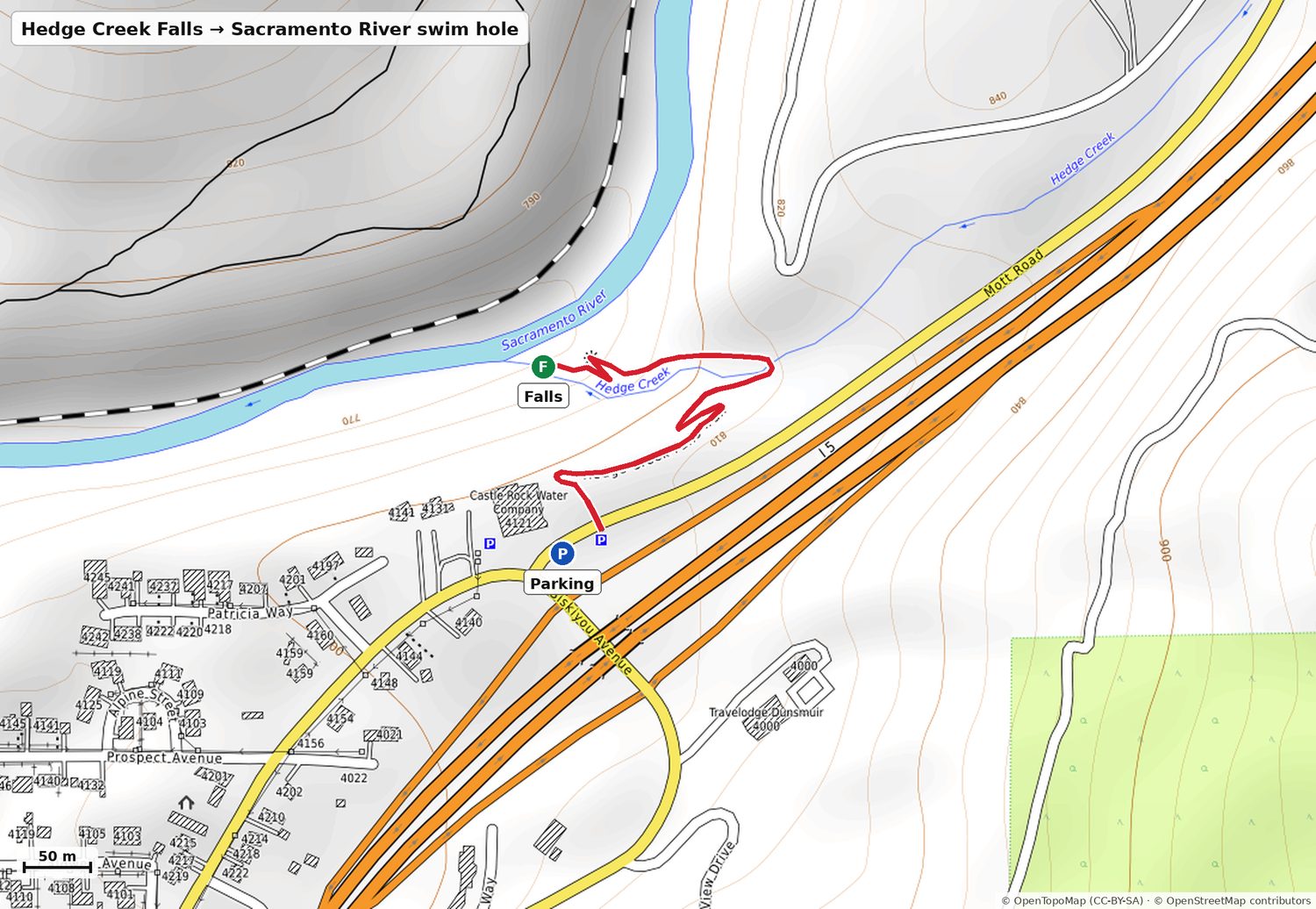
🚶 Hedge Creek: 0.3 mi down past the falls to the river (167 ft back up). Cantara: 0.25 mi flat along the river to a gravel beach
🚗 Detour: +30 min (Cantara is 16 min north)
🛍️ Bonus: small downtown Dunsmuir (shops open from 12)
🏠 Home ~7
📍 Cantara parking: https://www.google.com/maps/dir/?api=1&destination=41.26602,-122.30775

🅲 CASTLE CRAGS RIVER TRAIL
💧 Flat walk down to the rushing Sacramento, rocks to sit on and feet in the water, granite spires above
🌡️ Water ~15–17°C (estimate)
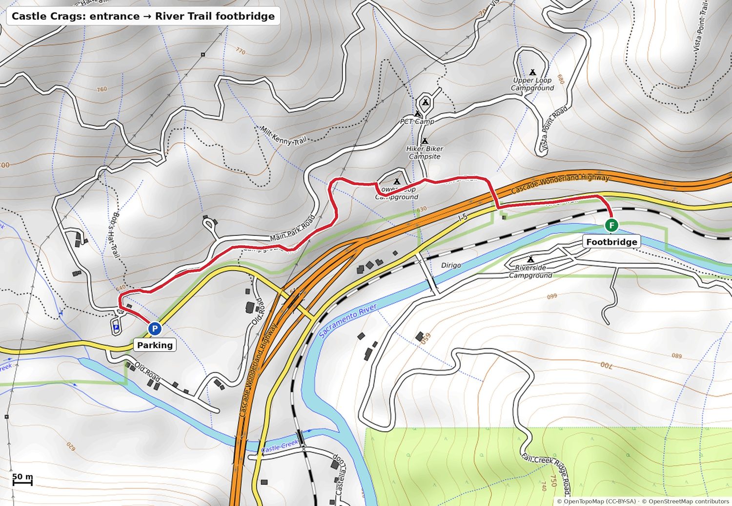
🚶 ~1.1 mi flat each way from the park entrance lot (~25 min). Follow the "River Trail" signs, under I-5
🚗 Detour: basically none (+5 min)
🎟️ $8/car
🛍️ Bonus: downtown Dunsmuir, 2 min from camp
🏠 Home ~6:30–7
📍 Park entrance: https://www.google.com/maps/dir/?api=1&destination=41.14781,-122.32040

🅳 CHICO, BIDWELL PARK (Big Chico Creek)
💧 Creek swimming holes. Bear Hole: clear pools in a rock gorge. Easier: One Mile / Sycamore Pool, flat and shady
🌡️ Water ~18–21°C (estimate). The warmest of the four
🚶 Bear Hole: park right above it (weekend dirt road), then ~100 yds of steep scramble. One Mile: a few steps from the car
🚗 Detour: +55 min (One Mile) / +85 min (Bear Hole)
🛍️ Bonus: the BEST downtown, Chico boutiques open till 6
🏠 Home ~7:30–8
📍 https://www.google.com/maps/search/?api=1&query=One+Mile+Recreation+Area+Bidwell+Park+Chico+CA
Option C: the Castle Crags River Trail from the entrance lot, about 1.1 mi, flat.
Weather & windDry all three days. The story is the wind: calm every morning, building hard after midday on Saturday.
🌬️ What the wind actually changes.Mornings are dead calm — 3–4 km/h at 9 am everywhere, which is exactly when the coffee-not-breakfast plan puts you at McCloud. Perfect for swimming and for photos.
Saturday afternoon is the windy window, and Burney is the worst of it: 22 km/h sustained gusting 36 km/h at 4 pm on an exposed rim. Drop to the base mid-window instead of standing up top.
Lake Siskiyou at sunset is the payoff — the wind collapses from 15 km/h at 4 pm to 6 km/h by 7 pm, so the lake should go mirror-flat right as the light turns. That reflection shot needs calm water, and you’re getting it.
Bunny Flat is the one to dress for: 17°C sounds fine until 15 km/h of wind makes it feel like 12°C, and Sunday morning up there is 7°C feeling like 4°C.
Where
Day
Temp
Wind
Gusts
Rain
Dunsmuir (camp)
Fri 25
12–26°C
11 km/h NW
19 km/h
9%
Sat 26
12–26°C
14 km/h NNW
22 km/h
1%
Sun 27
12–25°C
12 km/h NW
14 km/h
1%
McCloud Falls
Fri 25
10–24°C
10 km/h N
11 km/h
8%
Sat 26
9–25°C
18 km/h W
28 km/h
1%
Sun 27
10–24°C
15 km/h W
16 km/h
1%
Burney Falls
Fri 25
10–26°C
10 km/h WNW
13 km/h
6%
Sat 26
8–26°C
24 km/h WSW
37 km/h
1%
Sun 27
10–24°C
14 km/h W
17 km/h
1%
Bunny Flat (2120 m)
Fri 25
3–14°C
13 km/h NNW
19 km/h
9%
Sat 26
2–17°C
17 km/h SSE
22 km/h
1%
Sun 27
2–13°C
16 km/h NW
14 km/h
1%
Lake Siskiyou
Fri 25
10–22°C
13 km/h NNW
19 km/h
9%
Sat 26
11–25°C
16 km/h SSE
22 km/h
1%
Sun 27
11–24°C
11 km/h NNW
14 km/h
1%
Hour by hour, where you’ll actually be
When & where
Temp
Feels like
Wind
Gusts
9 am — McCloud Falls
14°C
12°C
4 km/h
17 km/h
1 pm — Burney, window opens
26°C
23°C
16 km/h
29 km/h
4 pm — Burney rim
26°C
21°C
22 km/h
36 km/h
4 pm — Bunny Flat
17°C
12°C
15 km/h
17 km/h
7 pm — Lake Siskiyou sunset
17°C
14°C
6 km/h
6 km/h
9 am Sun — Hedge Creek / Cantara
16°C
13°C
2 km/h
7 km/h
🛈 This is a 5–7 day forecast, so treat the numbers as the shape of the weekend rather than gospel — wind especially. Re-check Thursday; the temperatures will hold up better than the gusts. Model: Open-Meteo, elevation-corrected per site (camp 805 m, McCloud 1,007 m, Burney 902 m, Bunny Flat 2,110 m).
Can you actually get in?Short version. Tap a name for the parking pin and the map.
Every body of water on this page, with a late-September temperature and how much I trust it. Only one of these is an actual measurement — the rest are physical reasoning or estimates, and I've labelled which is which.
🧊 The thing this table actually tells you. Air will be 25–26°C and it will feel like swimming weather. It isn't, at most of these. The two lakes are the only genuinely warm water on the trip — everything fed by Mt Shasta's springs is 6–11°C, which looks inviting and empties your lungs on entry. If your parents want to actually swim rather than yelp and get out, point them at Lake Siskiyou on Saturday evening or Lake Britton during the Burney window. Cantara at 13–16°C is the good middle ground and it's 14 minutes from the door.
Every falls in detailParking pin, measured distance and grade, map of the walk, swim verdict.
Hedge Creek Falls
Dunsmuir — 3 min from camp
~30 ftSunday morning
💧
Wading only at the falls — the swim hole is further down
The falls drops into a shallow pool; there is no swimming under it. You can walk into the basalt alcove behind the curtain, which is the real reason to come. If you want to actually get in, carry on down the trail to where Hedge Creek meets the Sacramento — the current slows there and it's a proper (cold) swim hole with easy rapids below.
💧10–13°C creek · 14–16°C riverHedge Creek, and the Sacramento at the confluencePart measured
No gauge on Hedge Creek — that's a shaded-small-creek estimate. The river number is solid: the USGS gauge 6 km upstream at Cantara logged a mean daily max of 14.0°C for 20 late Septembers, and the water picks up a degree or so by Dunsmuir.
The creek pool under the falls is shallow and cold and you'd only be paddling anyway. The river swim hole at the confluence is the realistic swim — mid-teens, which a fit adult can happily do for 20–30 minutes.
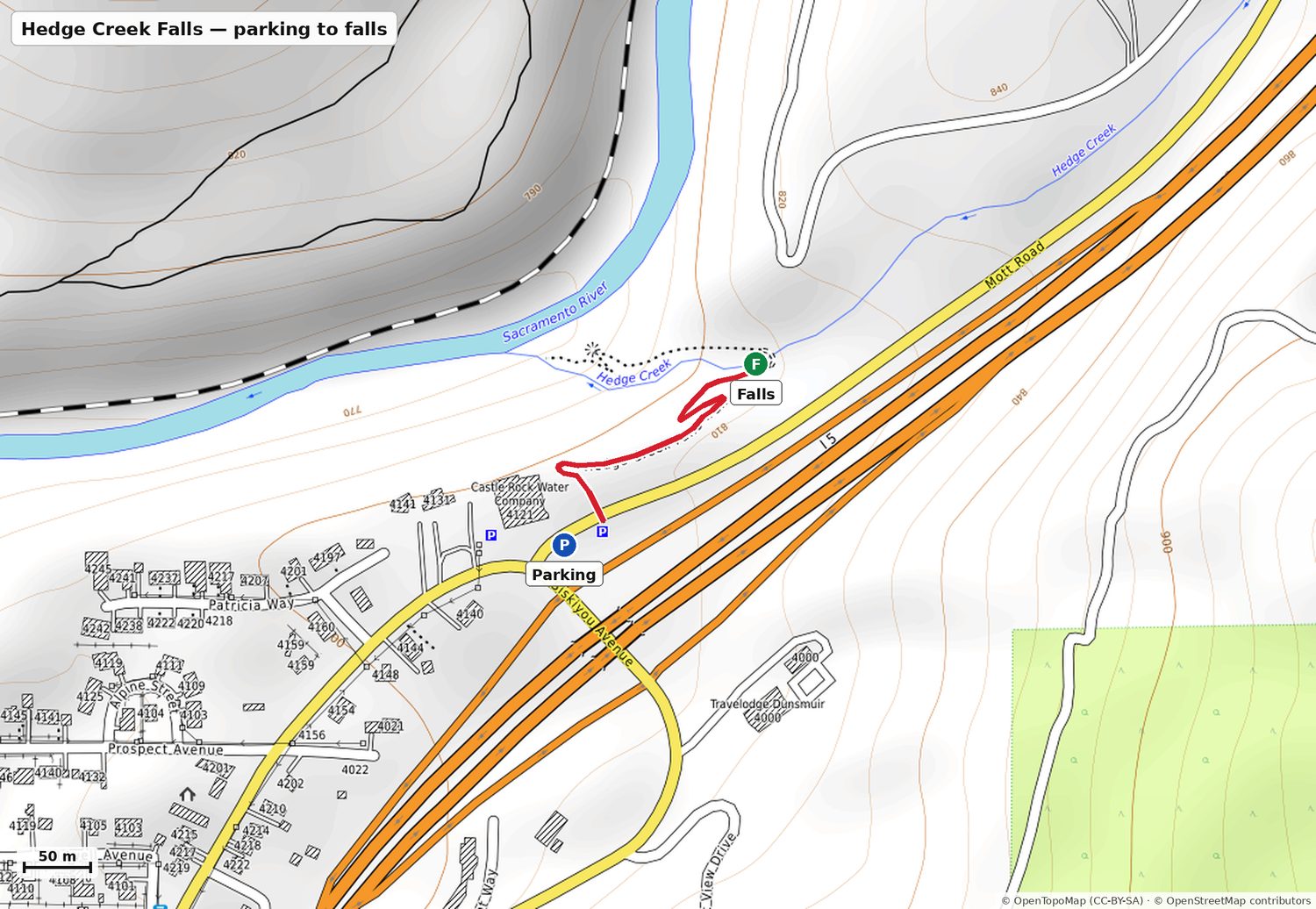
Parking: Hedge Creek Falls Parking, corner of Dunsmuir Ave & Siskiyou Ave. Free, unpaved, small — fills on weekends.
Parking → the falls (walk behind it)
Distance0.19 mi310 m, one way
Elevation76 ft down23.1 m net
Average grade7.5%moderate
Steepest stretch22.8%90th percentile
Downhill on the way in, so the climb is on the way back. Dirt + a short tunnel under I-5, rocky in a couple of spots. No railing.
Contours are 10 m. Red line is the actual mapped trail, measured on it.
The trail keeps descending past the falls to an overlook deck and the river. This is the steeper half — and it's 167 ft back up to the car from the bottom.
Contours are 10 m. Red line is the actual mapped trail, measured on it.
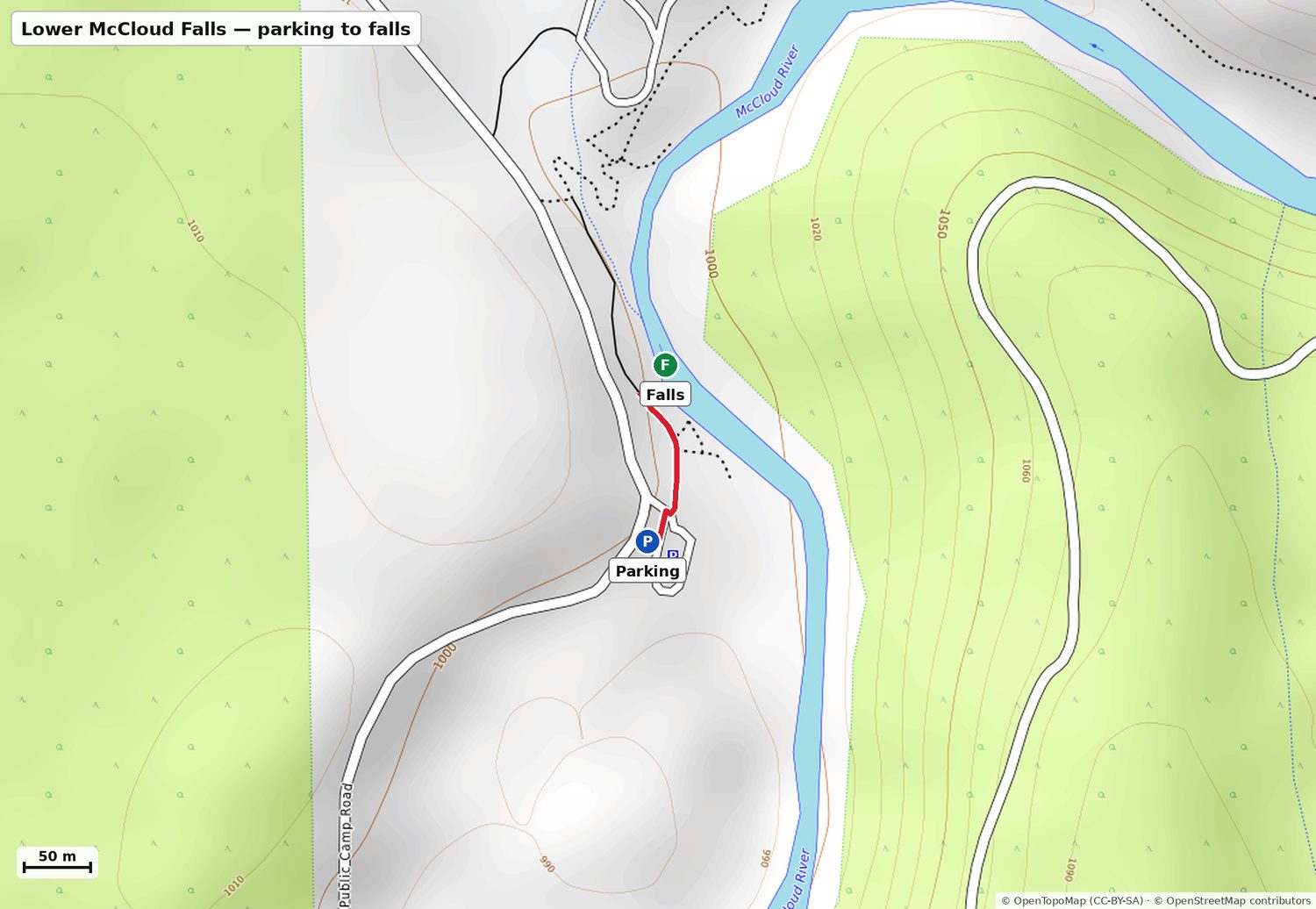
The best swimming hole of the three: a wide rock shelf to sit on, a stone staircase into the water, and a deep pool. Do not jump or dive — boulders have shifted into the popular jumping spots and it is now genuinely dangerous. Water is snowmelt-cold year round.
🧊8–11°CLower McCloud plunge poolWell established
The upper McCloud is spring-fed: Big Springs pushes a near-constant 7°C into the river year round, and it historically never left the river above 15°C. Visitors measure 45–52°F (7–11°C) at Lower Falls even when the air is near 38°C.
Swimmable, but this is properly cold. Expect the gasp reflex on entry — walk in down the stone stairs rather than jumping, and plan on 10–15 minutes in the water, not an afternoon.
Parking: Lower Falls Day Use Area lot, off Fowler Public Camp Rd. Free, toilets, picnic tables.
Parking → the falls
Distance0.08 mi132 m, one way
Elevation14 ft down4.2 m net
Average grade3.2%gentle
Steepest stretch22.9%90th percentile
Effectively flat — 145 steps-worth of nothing. A stone staircase drops from the rock shelf to the water.
Contours are 10 m. Red line is the actual mapped trail, measured on it.
Big plunge pool below a 50-ft curtain, and people swim it all summer. Same rule as Lower: no jumping. Late September water is 8–11°C — not “bracing”, genuinely cold. Bring a towel and something dry to change into.
🧊8–11°CMiddle McCloud plunge poolWell established
Same spring-fed water as Lower Falls, a kilometre upstream, plus constant spray off a 15 m curtain keeping the basin air cool.
Colder-feeling than Lower because of the spray and the shade. Fine for a quick swim; bring a towel and a dry layer to change into or the parents will be miserable in the wind afterwards.
Parking: Fowler Camp / Middle Falls trailhead lot (for the base). For the overlook only, use the Upper Falls lot instead — pin below.
⚠️ The switchback trail connecting the overlook down to the base drops 165 ft in a quarter mile (~12% average). Don't route the parents down it — drive round to Fowler Camp and walk in flat instead.
Fowler Camp lot → the base of the falls
Distance0.7 mi1130 m, one way
Elevation44 ft up13.5 m net
Average grade1.2%essentially flat
Steepest stretch4.8%90th percentile
THE parent-friendly route. Packed dirt along the river, near-level the whole way — 46 ft of gain spread over 0.7 mi. No scrambling, no stairs.
Contours are 10 m. Red line is the actual mapped trail, measured on it.
There is no sanctioned trail to the base of Upper Falls. People do get in the pools above the lip, which sit directly above a 40-ft drop into a narrow gorge — that's the one to say no to. Treat this as a viewpoint.
🧊8–11°CUpper McCloud (pools above the lip)Well established
Same river, same springs.
Academic — you're not getting in here. Cold water plus a slick basalt lip above a 12 m drop is the single most dangerous combination on this page.
Parking: Upper Falls lot (same lot as the Middle Falls overlook). Free.
Parking → the viewpoint
Distance0.41 mi663 m, one way
Elevation8 ft down2.5 m net
Average grade0.4%essentially flat
Steepest stretch10.0%90th percentile
Flat forest path along the rim — 36 ft of up and 43 ft of down across the whole 0.4 mi. Easiest walk of the weekend.
Contours are 10 m. Red line is the actual mapped trail, measured on it.
Burney Creek is spring-fed and runs about 6°C (42°F) with strong currents under the falls; swimming at the falls is not allowed. The legal swim is Lake Britton's beach, inside the same park about 1.5 mi north — bring suits if you want it.
❌6°CBurney CreekWell established
Entirely spring-fed from inside the basalt. The flow and the temperature are both constant year-round — the creek rarely gets above 42°F (6°C) in any season.
Do not get in, and it isn't only a rules thing. 6°C is cold-shock water: involuntary gasp, loss of breathing control within a minute, useful swimming ability gone in a few more. Lake Britton, 2.5 km north inside the same park, is 16–19°C — that's where you swim at Burney.
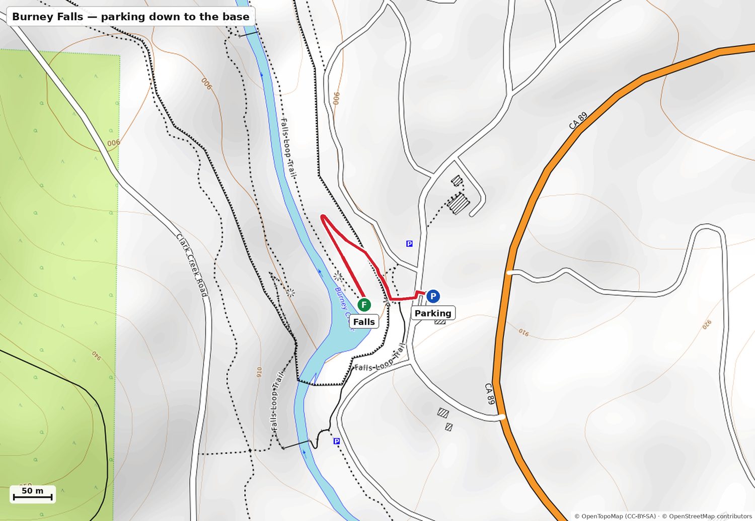
Parking: Main day-use lot (21 spaces + overflow). Reservation required Fri/Sat/Sun through Sep 27 — this is the final weekend of the pilot. Same-day reservations are NOT sold.
Parking → the base of the falls
Distance0.21 mi332 m, one way
Elevation132 ft down40.3 m net
Average grade12.1%steep
Steepest stretch49.3%90th percentile
The rim viewpoint is ~100 yards from the car on pavement — that alone is worth the trip and needs no effort. Going down to the base is 131 ft of descent on switchbacks with some stepped sections; the work is the climb back out.
Contours are 10 m. Red line is the actual mapped trail, measured on it.
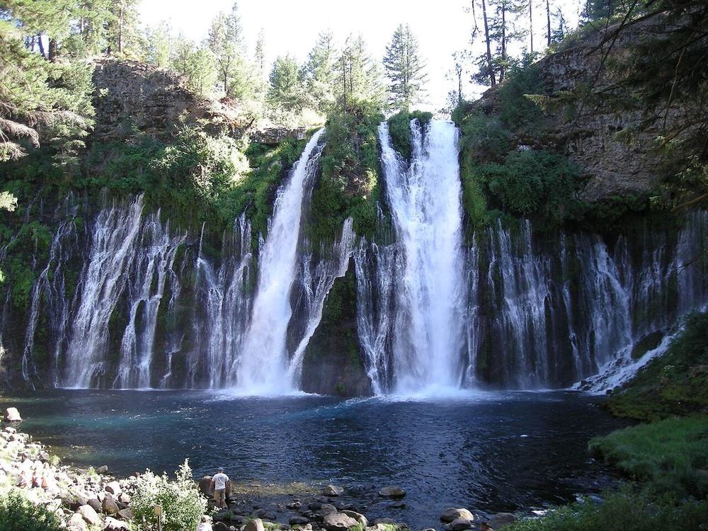
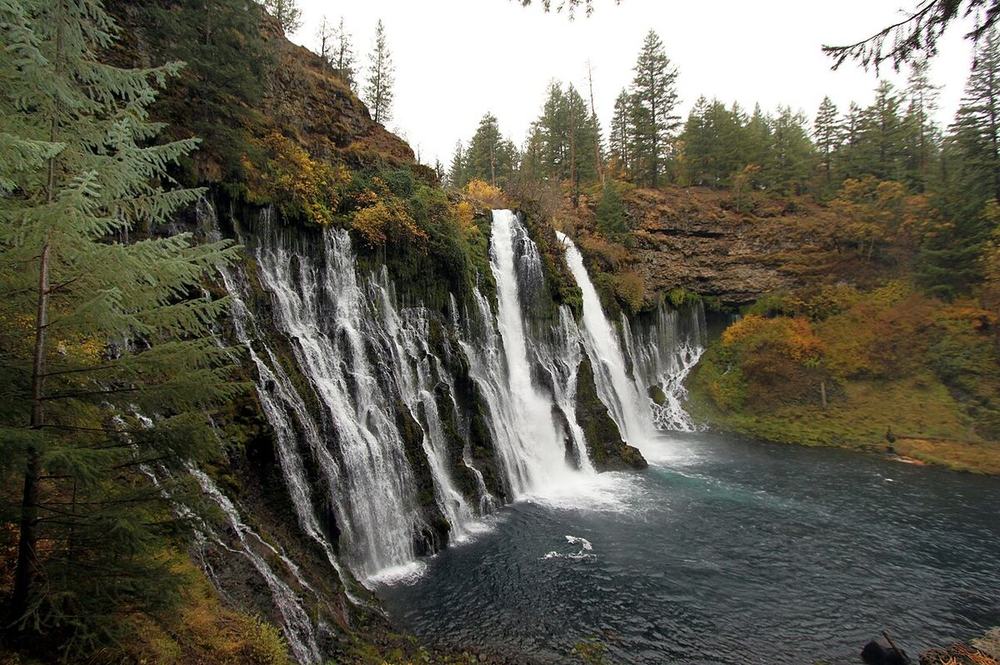
What it'll look like: 100 million gallons a day, year-round, straight out of the rock face. Unaffected by the dry season — the one guaranteed spectacle of the weekend.
A 40-ft cataract into a plunge pool you can swim. The catch is the access: the viewpoint at the top of the scramble is easy enough, the descent to the water is hands-on and loose. Parents to the viewpoint, swimmers down the scramble, or skip it entirely.
🧊10–13°CNey Springs CreekEstimate
Estimate, not a measurement — there is no gauge on this creek. A small, heavily-shaded forest creek at 1,200 m in late September sits a few degrees above the McCloud and below the Sacramento.
Cold and shallow, and you have to do a loose scramble to reach it. Treat the pool as a foot-dip rather than a swim, and don't route your parents down the last 150 m at all.
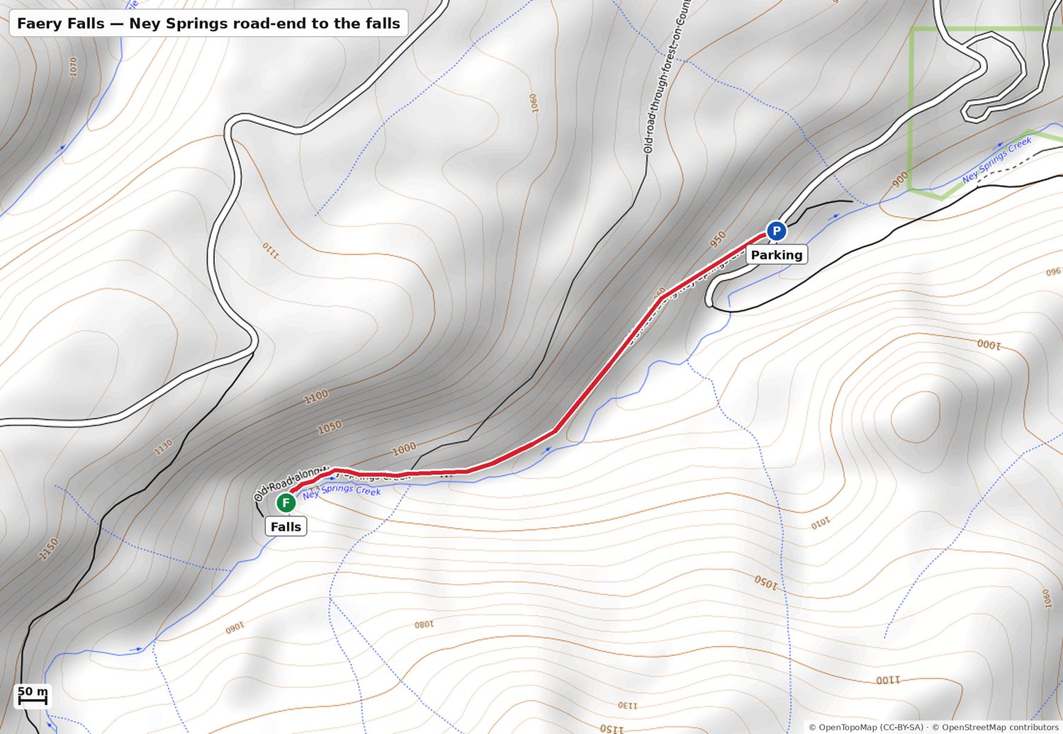
Parking: Roadside pullout where Ney Springs Rd stops being drivable. Unpaved and bumpy the last stretch — fine for a normal car taken slowly, not fine in the dark.
⚠️ The last 150 yards to the plunge pool is a use-trail scramble — OSM has it tagged loose steep slope, 15% grade, poor visibility. Fine for you and Preksha; not a route for the parents.
Road-end → the falls
Distance0.69 mi1108 m, one way
Elevation258 ft up78.5 m net
Average grade7.1%moderate
Steepest stretch13.3%90th percentile
Uphill on the way IN (259 ft over 0.7 mi) along an old roadbed, so the tired direction is the outbound one. Steady rather than steep — but it's the most walking of any falls here.
Contours are 10 m. Red line is the actual mapped trail, measured on it.
Closer to campYou asked what else is near the pin. Everything here is a 4–17 minute drive from the door — measured and mapped the same way as the rest.
📍 If you only add one thing:Cantara Loop. Fourteen minutes north, a flat quarter-mile along the river, and it's a real swimming hole with a beach rather than a viewpoint. It's what you do on Saturday if Burney runs short, or Sunday morning if nobody wants to drive.
Cantara Loop swim hole
Upper Sacramento River — 5.6 mi / 14 min north
No falls — riverHot afternoon, or Sunday
🚶
Yes — and it's the closest proper swim to camp
This is the local swimming spot, not a tourist one: a small beach, a slow deep pool, and nobody selling you anything. Late September river water runs 13–16°C by the afternoon — measured, not guessed; see the water-temperature note below. Cold on entry, fine once you're in, and a world away from Burney's 6°C spring. Current is gentle at the pool and picks up below it, so keep an eye on anyone who isn't a strong swimmer.
💧13–16°CUpper Sacramento RiverMeasured
This one is measured. USGS gauge 11341400 sits 400 m from the beach and recorded daily water temperature for 20 years. For 25–30 September the mean daily max was 14.0°C (range 10.0–17.3) and the mean daily min 11.4°C. The record ends in 1987, so add roughly a degree for regional warming since.
The best swimming water within 15 minutes of camp, and by a wide margin the warmest moving water on this trip. Mid-teens is a real swim for anyone reasonably fit — noticeably cold for the first minute, then fine. Go in the afternoon; it's ~3°C colder at dawn.
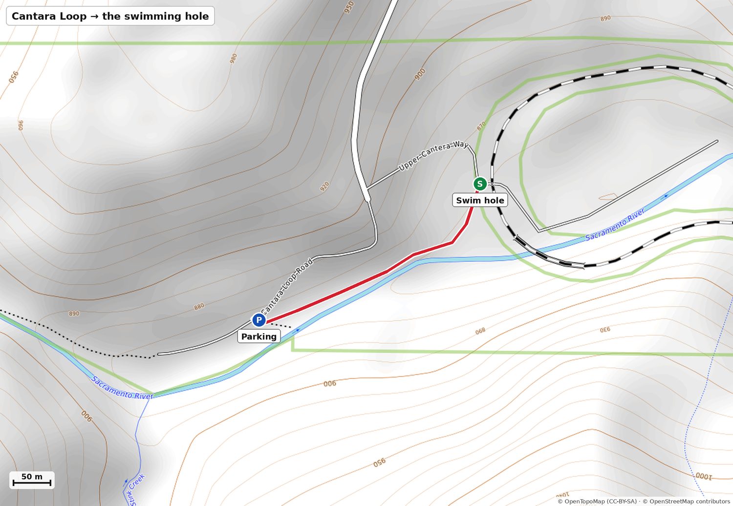
Parking: Dirt pullout at the bottom of Cantara Loop Rd. From camp: Dunsmuir Ave north to Mott Rd, 5 mi, left on Cantara Rd, 1 mi down to the river, turn right. Gravel and free. No toilets, no tables, no shade at the beach.
📜 The thing nobody mentions: this is the Cantara Loop. In July 1991 a Southern Pacific tanker derailed on this exact curve and dumped roughly 19,000 gallons of the soil fumigant metam sodium into the river, killing essentially every living thing for 45 miles down to Lake Shasta. The river recovered — it's been a blue-ribbon wild trout fishery again for two decades and the swimming is fine. Worth knowing because you'll be standing right under the curve it happened on.
Parking → the swimming hole
Distance0.24 mi388 m, one way
Elevation13 ft up4.0 m net
Average grade1.0%essentially flat
Steepest stretch6.3%90th percentile
A riverside footpath upstream, flat the whole way — 13 ft of rise across a quarter mile. Ends at a small gravel beach in the crook of the railroad loop. The easiest walk on this entire page.
Contours are 10 m. Red line is the actual mapped trail, measured on it.
A small chute into a shallow basin. People cool their feet; nobody swims it. If you want water on this side of the freeway, Castle Crags' river frontage on the Sacramento is a better bet.
🪹—Sweetbriar CreekNo data
Small rain- and snowmelt-fed creek with no gauge and no late-season flow data.
There may not be enough water to have a temperature. Don't plan on getting in.
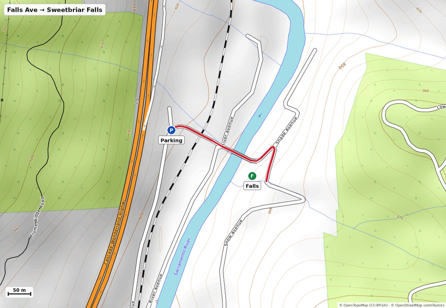
Parking: There is no lot. Take the Sweetbrier Ave exit off I-5, cross the river bridge and the railroad at the level crossing (a normal road crossing — nothing like Mossbrae), then pull over on Falls Avenue. It is a residential lane, so park considerately and don't block driveways.
⚠️ Set expectations low. The World Waterfall Database lists it as unconfirmed and flags that it may not carry enough flow to qualify as a waterfall at all in dry months. Late September is the driest it gets. Treat this as a five-minute leg-stretch if you are already stopping in Castella — not as a destination.
Roadside → the falls
Distance0.21 mi340 m, one way
Elevation39 ft down11.9 m net
Average grade3.5%gentle
Steepest stretch13.7%90th percentile
Walk east along Falls Avenue; the falls is about 30 m off the lane at the bend. Gentle, 40 ft of drop, two minutes of effort. Wheelchair-unfriendly at the very end but fine for anyone walking.
Contours are 10 m. Red line is the actual mapped trail, measured on it.
What it'll look like: Spring: a genuine 15–20 ft chute. Late September: possibly a damp rock. Go in with that framing and it can only surprise you upward.
Castle Crags State Park — 9.5 mi / 17 min south
Tiered, 500+ ft over the graniteSunday — upgrade to the Castle Crags stop$8/vehicle day use
⚠️
Hot-tub-sized pools, if there's water
Between the tiers there are small pools, but they sit at the top of the sketchy scramble and depend entirely on a flow that may not be there. Not a swimming plan — use Cantara or McCloud for that.
🪹—Root CreekNo data
Snowmelt-fed off the Castle Crags granite. Runs year-round as a creek but the falls itself often stops in a dry summer.
The pools between the tiers are hot-tub sized, at the top of a precarious scramble, and may be dry. Not a swimming plan.
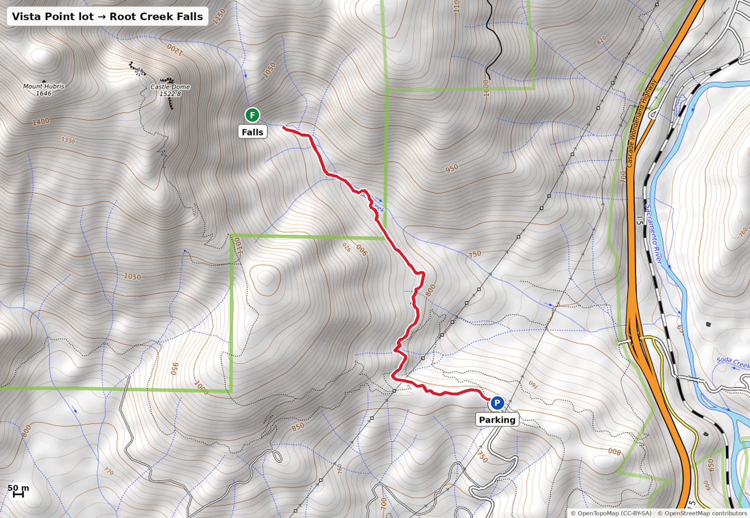
Parking: Vista Point Trailhead lot at the top of Vista Point Rd, inside Castle Crags SP. $8/vehicle, day-use gate 8 am to sunset, CA State Park passes accepted. The <b>same lot</b> has the paved 0.2 mi ADA Vista Point Overlook — so whoever doesn't want the hike gets the Crags-and-Shasta view with no effort at all.
⚠️ Two honest caveats. One: the mapped trail ends about 170 m short of the falls. Getting to the base means leaving the trail, staying on the south bank and climbing a faint use path that hikers describe as strenuous and precarious. That last stretch is a no for your parents. Two: Root Creek runs year-round but the falls largely switches off in a dry summer — one hiker found it bone dry in late July. In late September you are gambling. The Crags scenery pays out regardless.
Vista Point lot → end of Root Creek Trail
Distance1.55 mi2498 m, one way
Elevation303 ft up92.3 m net
Average grade3.7%gentle
Steepest stretch18.0%90th percentile
The only real hike within 20 minutes of camp, and a good one: a wide forested path under the granite spires, 302 ft of net climb but 476 ft of cumulative up-and-down across rolling ground. The first mile is graded near-flat; it steepens in the last third.
Contours are 10 m. Red line is the actual mapped trail, measured on it.
What it'll look like: When it runs, a long multi-tier ribbon down bare granite — the closest thing to a Yosemite wall in this county. When it doesn't, a very pretty forest walk with a dry cliff at the end.
Mossbrae Falls — 4 minutes away, and still the answer is no. It is by a distance the most beautiful waterfall in the area and it is the closest one to you. The only access is 1.2 mi along live Union Pacific track; people are cited for it and people have been killed on it. UP signed a trail easement in June 2026 but construction is years out. The honest substitute is Hedge Creek, which you can actually walk behind.
Burstarse Falls — 18 min south plus 2.75 mi each way on the PCT out of the Dog Trailhead. It's a good hike, but the creek is snowmelt-fed and late-season reports are consistently "a trickle" or "dried up". Not in September.
Wagon Creek Falls — a 35–40 ft plunge near Lake Siskiyou that almost nobody visits, for the good reason that it isn't on a maintained trail and runs seasonally. You're already going to Lake Siskiyou for sunset; take the Wagon Creek suspension bridge and the flat shoreline path instead.
Whitney, Ash Creek and Shackleford Falls — all in the "12 waterfalls near Dunsmuir" tourist lists. All of them are an hour-plus of driving, much of it dirt, for long exposed hikes. Wrong trip.
Skip these
Mossbrae Falls — still no legal access. The only way in is along live Union Pacific track and people do get cited. UP signed a trail easement in June 2026 but construction is years out. Don't.
Sengthong's, The Flamingo, Wayside Grill — closed for good. Poncho & Lefkowitz is closed Sundays.
Cliff jumping at any of the McCloud falls — boulders have shifted into the historic jumping spots. Swimming is fine; jumping is how people get hurt here.
Send to the family
⛰️ Shasta weekend — Sep 25–27

☀️ 12–26°C and dry all weekend. Mornings are dead calm; wind builds after midday and Saturday afternoon gusts 36 km/h at Burney. Bunny Flat is 2.5–17°C — pack a real layer.

☕ Mornings: cappuccinos at camp, no breakfast stop. Out the door by 8:15.

FRI — Alameda → Dunsmuir, 266 mi. Leave 4:30 to land by 9:30. Eat before you go or Black Bear Diner in Mt Shasta (open to 10). Dunsmuir River Days is on downtown.

SAT — McCloud Falls (35 min east). Lower = the swimming one, flat 0.08 mi from the car. Middle = the big one, flat 0.7 mi in from Fowler Camp lot (NOT the steep switchbacks). Upper = flat 0.4 mi, viewpoint only.
→ Burney is off. Pick B, C or D on the page.
→ Bunny Flat → Lake Siskiyou for sunset (6:59) → BBQ + propane fire back at camp.

SUN — Coffee at camp, check out. Hedge Creek Falls (3 min away) — you walk BEHIND it. Castle Crags viewpoint. Then I-5 south, Shasta Dam tour on the way, home ~7:30.

🏊 Can you get in? (water temps, not air)
Lower McCloud YES but 8–11°C · Middle McCloud YES, same 8–11°C · Upper McCloud no · Cantara Loop YES, 13–16°C, the good one · Lake Siskiyou 17–19°C, the warmest water of the trip · Burney NO (6°C, prohibited — Lake Britton beach instead) · Hedge Creek wade only, swim hole is further down at the river · Faery Falls yes but a scramble

⭐ Near camp (new): Cantara Loop swimming hole, 14 min north — flat 0.24 mi along the river to a beach and a deep pool. Best swim close to camp. Also Root Creek Falls (Castle Crags, 17 min) — lovely 1.55 mi walk, but the falls may be dry in September. Mossbrae is 4 min away and still illegal — don't.

🧳 Packing list, tick as you pack (syncs between phones): https://artifact.sahirm.com/a/shasta-weekend-sep-2026/#packing

Full page with parking pins + walk maps: https://artifact.sahirm.com/a/shasta-weekend-sep-2026/